National Weather Service warns of more storms Monday
Published 5:31 pm Sunday, March 26, 2023
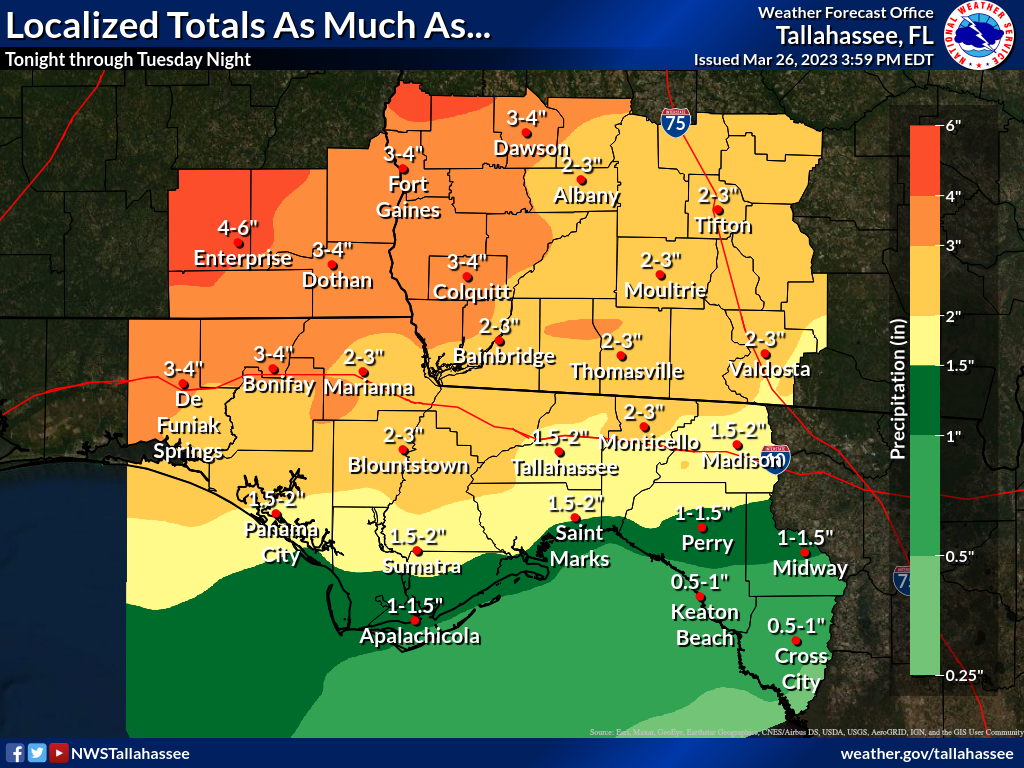
- Reasonable Worst Case Rainfall - Localized Totals
MOULTRIE, Ga. — Concerns about severe weather not only continue Monday, they will actually increase, according to an email from the National Weather Service to The Observer Sunday afternoon.
The NWS predicts a slight risk of severe thunderstorms Monday (level 2 of 5) following marginal risks (level 1 of 5) on Saturday and Sunday.
“A stationary front currently over central Alabama and central Georgia will move southward into southern Alabama and southern Georgia,” the NWS said. “A broken line of thunderstorms will move into southeast Alabama and southwest Georgia around mid-morning, moving slowly southeastward through the day. The individual cells in the line will pose a large hail and damaging wind risk.
“While the tornado risk is a bit lower, it is non-zero, and a brief tornado or two cannot be ruled out,” the forecast said. “The storms move toward the I-10 corridor by late afternoon or early evening before diminishing in intensity.”
There is also a marginal risk of excessive rainfall both Monday and Tuesday across the area.
The NWS Tallahassee office’s website at weather.gov/tae reported three incidents of damage in Colquitt County from storms that came through about 1 p.m. Saturday:
• Tree down near Gin Creek.
• Power lines down on Highway 37 West.
• Utility pole reported down, 1 mile southeast of Moultrie.
Damage was also reported in several of the surrounding counties.
Severe storms struck Mississippi and Alabama Friday night, killing at least 26 people. The same storms struck middle Georgia on Saturday, and Gov. Brian Kemp declared a state of emergency on Sunday morning.
At least one tornado was indicated by radar Sunday morning in LaGrange, Ga., according to NBC News.
Also on Sunday, President Joe Biden declared a major disaster in Mississippi, where most of the deaths occurred.