Tornado watch in effect; severe weather possible through Saturday
Published 9:35 am Wednesday, March 9, 2022
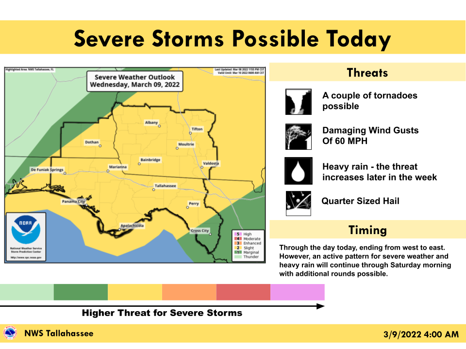
- Severe storms possible today
MOULTRIE, Ga. — The National Weather Service issued a tornado watch throughout the region this morning ahead of what’s expected to be an active weather day.
The watch began at 8:58 a.m. and continues until 1 p.m. Since storms are expected to arrive in the late morning, the tornado watch could be extended.
Trending
In addition to Colquitt County, the watch includes 25 other Georgia counties plus seven counties in Florida.
The Weather Service updated its forecasts this morning, upgrading most of southwest and south central Georgia — including Colquitt County — to a slight risk of severe weather. As of Tuesday the risk had been considered marginal, the lowest category, but it’s been raised one level as of this morning. Severe weather risks continue through Saturday.
A disturbance will bring the potential for severe storms to the region today, the NWS notice said. An active pattern will continue through early Saturday morning with additional severe weather possible Friday and Friday night.
Potential hazards include damaging wind gusts, a few possible tornadoes, quarter-sized hail and heavy rain. The rain threat increases later in the week, the NWS said, and raises the possibility of flooding.
“A line of storms will move through the region from west to east today with additional showers and thunderstorms possible tonight,” the Weather Service said.
The NWS provided a graphic that divides the region into three bands based on when the storms are expected to arrive. The western half of Colquitt County is in the second band with storms expected to start between 9 a.m. and 3 p.m., while the eastern half is in the third band, from 11 a.m. to 7 p.m.
Trending
The Weather Service said thunderstorms are possible Thursday but are unlikely to be severe in South Georgia. The most likely threat will be localized damaging wind gusts.
The severe weather threat covers the entire region again on Friday and Friday night. The main hazards will be damaging winds and possible tornadoes.
“A cold front will move through the region on Saturday,” the NWS said. “Ahead of this, additional severe weather is expected Friday through Friday night. Given this is still a few days away, timing and details may change.”
The Weather Service predicts an average 1 to 1 1/2 inches of rain in Colquitt County today, although some areas will be heavier. If heavy rain falls in a localized area in a short period of time, isolated flash flooding is possible.
Rain is expected to be heavier between Thursday and Saturday, though, with Colquitt County expected to receive an average of 2 to 3 inches over that period, so isolated flash flooding will be an even greater possibility.
Saturday’s front will bring colder temperatures too, the Weather Service warned. Lows in the mid 20s to lower 30s will be possible Saturday night with wind chills in the lower to mid 20s.