Weather Service expects another round of storms Tuesday night, Wednesday
Published 5:46 pm Monday, March 21, 2022
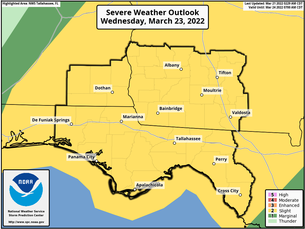
- The National Weather Service office in Tallahassee predicts a slight risk of severe weather throughout the region. Slight risk is the second of five levels on the NWS scale.
MOULTRIE, Ga. — Storms are expected to hit South Georgia Tuesday night and Wednesday. They follow three other waves of thunderstorms that hit the region in the last week and a half.
The National Weather Service said in its Monday afternoon briefing that strong to severe thunderstorms are possible late Tuesday night into Wednesday.
Trending
“Damaging winds and tornadoes are the primary threats,” the briefing said. “Secondary threats are heavy rainfall, windy conditions outside of storms, high surf, strong and frequent rip currents, rough seas, and dense marine fog.”
Graphics with the briefing indicated that Colquitt County might face minor thunderstorms Tuesday night, although Georgia’s westernmost counties and parts of Florida and Alabama have a chance of severe weather. By Wednesday, though, the entire region is in an area of slight risk — Level 2 on the weather service’s five-tier scale.
“A squall line along/ahead of a strong cold front is poised to bring strong to severe thunderstorms to the area, beginning in southeast Alabama and the Florida Panhandle late Tuesday night into Wednesday morning, then across southern Georgia and the Florida Big Bend on Wednesday,” the NWS said. “Storms will be capable of producing damaging winds and isolated tornadoes, with localized flooding possible.”
The forecast said the greatest threat window appears to be around daybreak on Wednesday, and the severe threat is expected to diminish from west to east through Wednesday afternoon.
Colquitt County Emergency Management Director Justin Cox reported no significant damage in the county following the earlier waves of storms March 12 and 18, while storms that were predicted for March 16 stayed south of Colquitt County.