Severe weather possible late tonight, early Wednesday
Published 10:44 am Tuesday, April 2, 2024
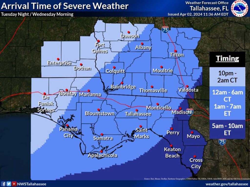
- Weather timing update
***UPDATE***
The National Weather Service in Tallahassee has updated its warning to an Enhanced (level 3 of 5) risk of severe weather across portions of southeast Alabama and into Southwest Georgia.
Trending
There is an an increase in the potential risk for a strong tornado or two (EF2+) early Wednesday morning.
The potential arrival times of the severe weather threat tonight into early Wednesday morning have also been updated.
MOULTRIE – The National Weather Service in Tallahassee warns that severe thunderstorms are possible between late this evening and early Wednesday morning.
According to the agency, “A broken line of thunderstorms will move southeast out of Central Alabama late this evening, reaching the Alabama Wiregrass sometime between late this evening and the wee hours of Wednesday morning. This line will continue to move southeast across our Georgia and Florida counties during the pre-dawn hours Wednesday morning, finally exiting past the Lower Suwannee Valley late Wednesday morning.”
The line of thunderstorms has a possibility of strengthening in the middle of the night as it passes across Southwest Georgia and the Florida Big Bend region, which could lead to an increased tornado threat.
All types of severe weather are possible with this event including large hail and damaging wind gusts.
Trending
The National Weather Service advises that residents have multiple ways to receive severe weather warnings including ways that will wake them up at night.
Residents of Colquitt County can sign up for the free CodeRed alert system, a high-speed emergency mass notification system provided by OnSolve, on the County’s website.