Severe weather possible Wednesday
Published 10:14 am Tuesday, January 3, 2023
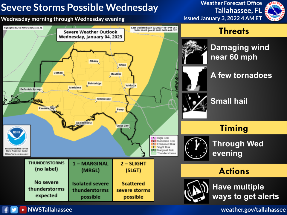
- Severe weather Wednesday
MOULTRIE, Ga. — The National Weather Service’s Tallahassee office warned of storms across its coverage area this afternoon into Wednesday.
“Severe weather will be possible both this afternoon and evening and once again throughout the day tomorrow ahead of an approaching cold front,” the NWS said in an email Tuesday morning. “Scattered showers and thunderstorms are possible across the western portions of our area later this afternoon and evening. These storms could become strong to severe with damaging winds, tornadoes (perhaps strong), hail, and heavy rainfall possible.
“Another round of more widespread showers and thunderstorms is expected tomorrow (Wednesday) as a cold front pushes eastward across the area,” the email said. “Once again damaging winds, tornadoes, hail, and isolated heavy rainfall will be possible with these storms.”
Graphics that accompanied the email indicate Colquitt County may have thunderstorms today but probably not severe weather. That changes with the Wednesday forecast, though, which puts the county in an area of slight risk, the second of five levels of concern.
A flood watch has been issued for Coffee, Dale and Henry counties in southeastern Alabama and Clay, Quitman and Randolph counties in southwestern Georgia through Wednesday, but the weather service said isolated pockets of heavy rainfall are possible anywhere in the area over the next two days.