Dorian’s effects could be felt Monday
Published 3:48 pm Friday, August 30, 2019
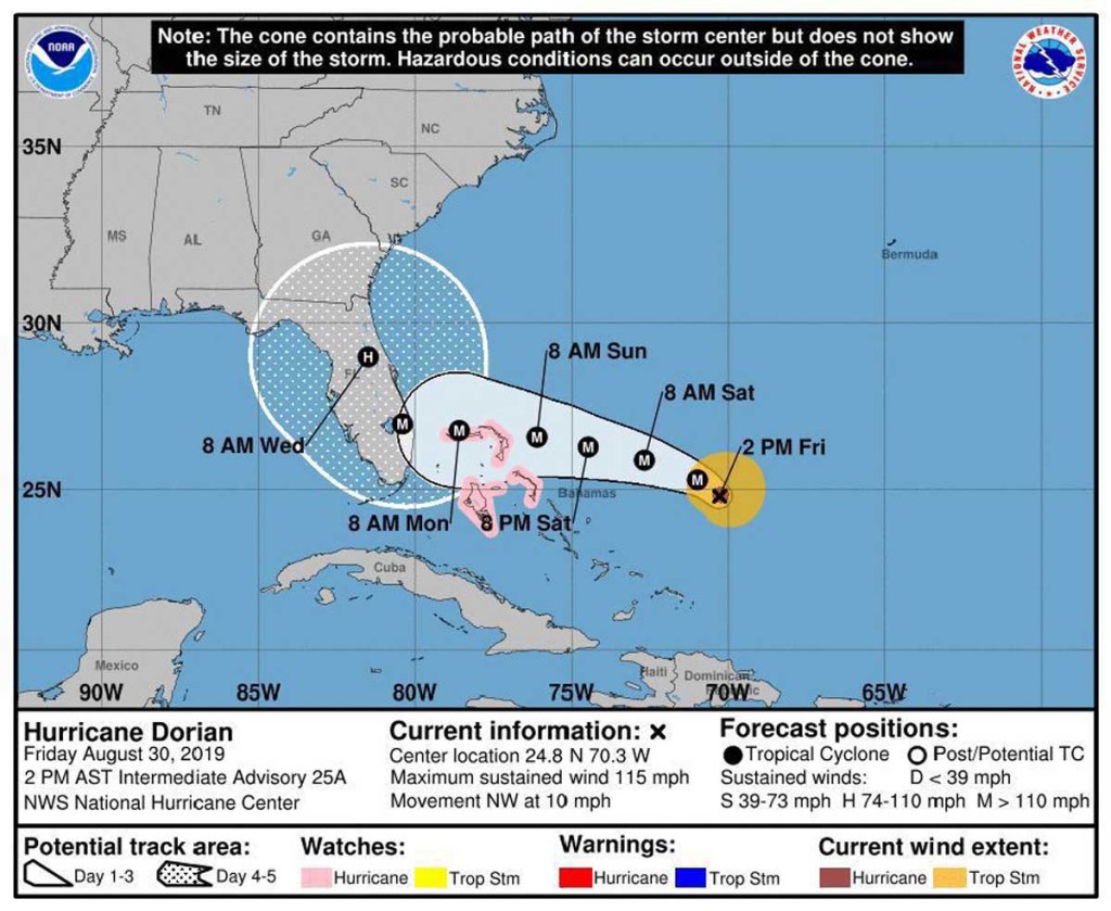
- Hurricane Dorian projection
TALLAHASSEE, Fla. — The National Weather Service is advising residents in southwest Georgia to prepare for possible tropical storm-force winds early next week as Hurricane Dorian travels across the Florida peninsula.
Winds of around 40 mph may arrive as early as late Monday evening, though Blair Scholl, meteorologist with the NWS, said they’re more likely to arrive Tuesday afternoon.
Trending
“There is about a 4 in 10 chance of Thomas County receiving tropical storm-force winds during that timeframe,” Scholl said.
Residents should expect rainfall of around 1 to 2 inches, though those figures can increase if the storm stays on a more westerly track into the Gulf of Mexico.
Residents are encouraged to clear loose tree limbs on their property and to clean sewers and gutters to prevent localized flooding.
Dorian, currently a Category 2 hurricane moving northwest from about 400 miles east of the western Bahamas, is expected turn due west toward the Florida peninsula sometime within the next 24 hours.
Landfall as a Category 4 hurricane with wind speeds of around 140 mph is expected to occur somewhere along the east-central or southeastern Florida coast either late Monday night or Tuesday morning, Scholl said.
Wind speeds are expected to weaken considerably as the storm travels across the Florida peninsula.
Trending
The storm will begin moving northwest again either Tuesday or Wednesday before turning north, and the uncertainty as to when that last turn occurs could have consequences for southwest Georgia.
Scholl said the most plausible track is that the northward turn occurs early and the storm travels directly up the spine of the Florida peninsula, though there is a small possibility that the storm could first enter the Gulf of Mexico, where it can gather more powerful rains.
The NWS encourages residents to prepare hurricane kits including flashlights, extra batteries and a first aid kit and to secure vital supplies such as medications.